INSTITUTE OF HISTORICAL RESEARCH (IHR/NHRF) > Section of Neohellenic Research (SNR)

Cultural History

Economic and Social History

Political History


Geographical Culture and History of Cartography

The Programme belongs to the broader domain of cultural history and the history of ideas. It attempts to explore the role of geographical representations as social, political and cultural constructs and is devoted to the historical study of perceptions and representations of space -textual and graphic- and their implications on cultural, social and political history. 

The programme focuses chiefly on the history of perceptions and representations of Greece and their impact on the construction of Modern Greek identities. Within the programme's framework, specific independent research projects have been developed over the last 15 years, either sponsored by various national and international institutions (public and private) or in collaboration with broader national and international networks. Their fields of inquiry are related to:

  • the building of local and regional territorial identities
  • early modern maritime cartography
  • concepts of insularity and representations of insular space
  • sacred topography and its social and cultural functions
  • antiquarian and patriotic interest in historical space
  • the formation of Greek national territoriality

The research programme has organized post-graduate seminars in Greece and abroad; it sustains a database of the related material (http://pandektis.ekt.gr/pandektis/handle/10442/23163); it publishes books and articles on a variety of topics, such as the history of perceptions of Greek space, the history of Greek cartography and the cartography of Greece, travel literature and geography, studies on the perception and functions of historical space and the history of Greek archaeology. Several scholars, senior and junior, have collaborated on the programme, as well as post-graduate students and postdoctoral researchers.


Members

George Tolias, Research Director, Supervisor

Other Members

Post doctoral researchers: Eleni Gadolou, Post doctoral fellow

External collaborators
Dimitris Loupis
Anca Dan (2010-2011)
Sonja Brentjes (2013)
Ewa Janion (2012-2014)


Research Projects

2018: «Insularities». Funded by the Environmental and Cultural Park of Paros.

Accomplished:

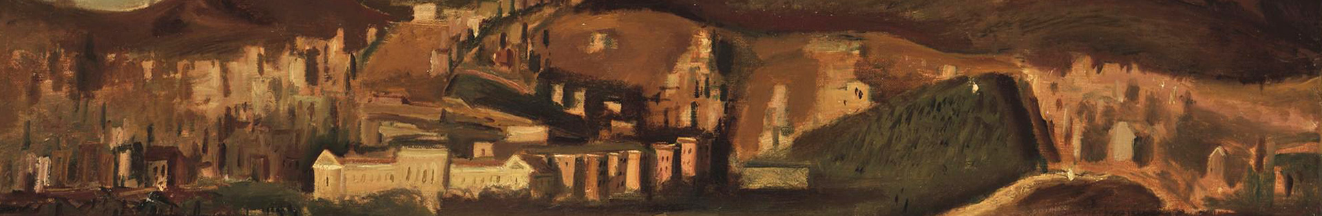
  • 2018: “The historical landscape at the end of the Greek War of Independence: The French Scientific Expedition to Morea (1829)”. Funded by MOREAS SA http://94.70.254.130:8080/moreasweb/
  • 2006-11 “History of Cartography of Greece”. Funded by the Samourkas Foundation. 
  • 2007 “Island Cartographies”. Funded by the European Union, within the framework of the Ramses2 Network of Excellence.
  • 2005-07 Following Pausanias: The Quest for Greek Antiquity”. Funded by the European Union, and the Greek Ministry of Development and Ministry of Culture. 
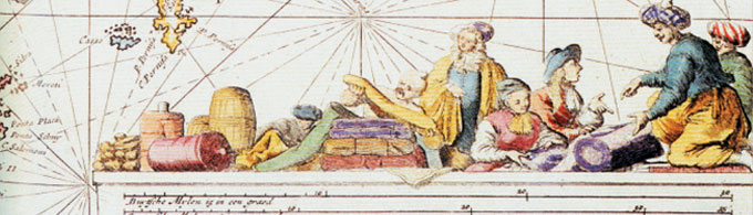
  • 2005-07 Greek Cartography: The Documents (15th-19th Centuries)”. Funded by the European Union - European Regional Development Fund and the Greek Public Domain (3rd CSF 2000-2006), within the framework of “PANDEKTIS: A Digital Thesaurus of Primary Sources for Greek History and Culture”.
  • 1998-99 “Mediterranean Cartography”. Funded by the I.F. Kostopoulos Foundation.
  • 1997-99  “The Greek Portolan Charts”. Funded by the European Union, the General Secretariat of Research and Technology and Olkos Publications.


Conferences and Events
  • 2007: Island Cartographies: Knowledge and Power / Cartographie des iles. Enjeux de savoir - enjeux de pouvoir, Ermoupolis, Syros, 16-17 July. Within the framework of the European Network of Excellence RAMSES 2 and the Ermoupolis Seminars of the IHR/NHRF.
  • 2007: Στα βήματα του Παυσανία: η αναζήτηση της ελληνικής αρχαιότητας [In the footsteps of Pausanias: the quest for Greek Antiquity], Athens, May 3-5. International Symposium co-organized by the NHRF and the Gennadeios Library/American School of Classical Studies within the framework of the Project “Open Doors” of the 7th ESF.
  • 1999: 18th International Conference on the History of Cartography, Athens, NHRF and the Gennadeios Library/American School of Classical Studies, July 11-17 1999. Co-organized by the Greek Cartography Society and Imago Mundi Ltd.
  • 1996:Η εικόνα της Ελλάδας στην Δύση, 17ος – 19ος αιώνας: νέες προσεγγίσεις, Διεθνής συνάντηση[The Image of Greece in the West, 17th-19th c.: New Approaches, International Conference], Athens, April 23. Organized by the Center of Neohellenic Research/NHRF and funded by the Ministry of Culture.


Collaborations

Collaboration with several Greek foundations.

International collaborations

  • 2010-2014, Member of the four-year international PhD project in the Humanities, The Traditions of Mediterranean Humanism and the Challenges of Our Times: The Frontiers of Humanity. Conducted by the Institute for Interdisciplinary Studies 'Artes Liberales' of the University of Warsaw (project director: Prof. Jerzy Axer). The project has been designed by an international team of 36 scholars and is devoted to the interdisciplinary exploration of the traditions of Mediterranean humanism faced with the challenges of our contemporary world.
  • 2009-2013, Member of the Bibliotheque Nationale de France Projet d'Anville. Coordinator: Catherine Hoffman. The project is devoted to the study and publication of the work of J.B. Bourguignon d'Anville, a leading humanist geographer of the French Enlightenment.
  • 2007-2010, Member of Ramses-2: Euro-Mediterranean Research Network of Excellence [Ramses-2. Reseau euro-mediterraneen des centres de recherche en sciences humaines sur l'aire mediterraneenne] (2005-2008). Work Package I.1: Memoires en Mediterranée, entre histoire et politique. Ramses-2 groups 30 research institutions and different research units, Centre National de la Recherche Scientifique (France), research units within the Euro-Mediterranean area. It is funded by the European Commission within the framework of the European Research Policy (FP6). The Ramses2 Network is coordinated by the CNRS.
  • 2000-2002, Member of the Project CULTUCADSES, financed by the European Union (FESR), Interreg II (Italia-Slovenia) in collaboration with the Marco Polo System. Coordinators: Paolo Costa and Giandomenico Romanelli. Member of the scientific committee of the Museo Correr's sub-project "Navigare e descrivere", coordinated by Camillo Tonini and Piero Lucchi.
  • 1999-2004, Member of The History of Cartography Project. Coordinator: David Woodward, University of Wisconsin-Madison. Member of the project for the preparation of volume three, Cartography in the European Renaissance.


Prizes - Distinctions
  • Invited Professor, École Normale Supérieure (2014).
  • The Academy of Athens Prize (2013).
  • Inited Professor, École Pratique des Hautes Études (IVe section, 2009).
  • Imago Mundi Prize (2007).
  • David Woodward Fellow, University of Madison – Wisconcin, Institute for Research in the Humanities (2001).
  • Seeger Fellow, Princeton University, Program in Hellenic Studies (1997).
  • Zappas Prize, Association pour l'encouragement des etudes grecques (1999).


Publications

Monographs

G. Tolias (ed., in collaboration with N. Bouloux και A. Dan), Orbis disciplinae: hommages en l’honneur de Patrick Gautier Dalché, Turnhout, Brepols, 2017, 841 p.
- (ed., in collaboration with Gilles Grivaud), Cyprus at the Crossroads: Geographical Perceptions and Representations of Cyprus from the 15th Century, Athens, Sylvia Ioannou Foundation, 2014, 245 p.
- Mapping Greece, 1420-1800: Maps in the Margarita Samourkas Collection. Catalogue of maps compiled by Leonora Navari, New Castle, Delaware – Athens, Oak Knoll Press, ‘t Goy-Houten: HES & DE GRAAF Publishers and NHRF, 2012, 546 p.
- (ed.), Αιγαίοπέλαγος, χαρτογραφίακαιιστορία, 15ος-17οςαιώνας (κατάλογος έκθεσης) [The Aegean Sea, Chartography and History 15th-17th c.] (exhibition catalogue), Athens, NBGCF, 2010, 276 p.
-, Challenged Territories: Cartographies of Greece and the Levant during the Ottoman Era, Analecta Isisiana CXII, Istanbul, Isis Press, 2010, 255 p.
-, Χάρτες και ιστορίες. Ελληνικές τοπογραφίες της Αναγέννησης και των Φώτων [Maps and Histories. Greek topographies of the Renaissance and the Enlightenment], Thessaloniki, Zitis, 2008, 256 p.
- (ed., in collaboration with M. Georgopoulou, C. Guilmet, Y. Pikoulas and C. Staikos), Following Pausanias: The Quest for Greek Antiquity, New Castle, DE / Athens, Oak Knoll Press for the NHRF and the Gennadeios Library, 2007, 253 p.
- (ed., in collaboration with D. Loupis), Eastern Mediterranean Cartographies, INR/NHRF, Tetrádia Ergasías 25/26, 2004, 404 p.
-, ΤαΝησολόγια: ησυντροφιάκαιμοναξιάτωννησιών [Nisologia: the Companionship and Loneliness of the Islands], Athens, Olkos, 2002, 192 p.
- (ed., in collaboration with F. Dacoronia, D. Cotoula, E. Balta and V. Sythiakaki), ), Λοκρίδα: ιστορίακαιπολιτισμός [Lokris, History and Culture], Athens, Ktima Chadjimichali, 2002, 190 p.
-, Greek Cartography in Print, 16th-19th century, from the Gennadius Library Collections, (exhibition catalogue), Athens, Society for Hellenic Cartography / Centre for Néohellenic Recherche / Imago Mundi Ltd., 1999, 40 p.
-, The Greek Portolan Charts, 15th-17th century: A Contribution to the Mediterranean Cartography of the Modern Period, Athens, NHRF and Olkos, 1999, 219 p.
-, La Médaille et la Rouille, Images de la Grèce Moderne dans la Presse Littéraire Parisienne 1794-1815, Paris & Athènes, Hatier & librairie Kaufman, 1997, 530 p.
-, (ed), Οπυρετόςτωνμαρμάρων: Μαρτυρίεςγιατηλεηλασίατωνελληνικώνμνημείων 1800-1820: ΤαΕλγίνεια, οναόςτηςΑφαίαςστηνΑίγινα, οναόςτουΕπικούρειουΑπόλλωνοςστιςΒάσσες, ηαρπαγήτηςΑφροδίτηςτηςΜήλου [Marble fever: Testimonies for the looting of Greek monuments 1800-1820: the Elgin marbles, the temple of Aphaia in Aegina, the temple of Epicureus Apollo in Vasses, the plunder of Aphrodite of Milos], Athens, Olkos, 1996, 262 p.
-, British Travellers in Greece 1750-1820 (exhibition catalogue), Athens and London, Foundation for Hellenic Culture, 1995, XXX και 106 p.
- (ed), Ανταποκρίσεις από την Ελλάδα 1879-1897. ΚείμενατωνJoseph Reinach, Charles Maurras kai Jean Moréas [Reporting from Greece 1879-1897. Texts on Joseph Reinach, Charles Maurras and Jean Moréas], Athens, Olkos, 1993, 143 p.
- (ed.), Mani, a Cultural Itinerary, 1993-1994: Travelers to the Mani, 15th-19th century, an Exhibition of Historical Material, (exhibition catalogue), Athens, CNR/NHRF, 1993, 144 p.
- (ed.), The Cartography of Hellenism 1830-1930: One Hundred Years, (exhibition catalogue), Athens, Society for Hellenic Cartography / Hellenic Literary and Historical Archives, 1992, 80 p.


© National Hellenic Research Foundation (NHRF), 48 Vassileos Constantinou Ave., 11635 Athens, Greece, Tel. +302107273700, Fax. +302107246618