The project aims to collect and classify systematically the textual and visual material derived from travel literature concerning South-Eastern Europe and the Eastern Mediterranean dating from the late fifteenth to the beginning of the twentieth century.
The existing database information system was redesigned in order to meet international standards of data management, as well as the needs of a much more extensive and systematic research. The existing database is integrated into a geographical information system (GIS) in order for the user to have the possibility to search but also make use of statistical formulae for all the related travel literature material through a digital map. The researcher could choose the territories he is interested in and study the statistics across a chronological and a geographical axis. Moreover, the documentation of illustration subjects will be reorganized in order to answer queries related to image management and visualization in travel books as a tool of producing or keeping social memory.
In the near future, the project will focus on:
the indexing of travel narratives, including also those of the twentieth century
the indexing of the content of travel guides and travelogue journals issued during the nineteenth century in Europe and the United States (Tour du Monde, Annales des Voyages, Bulletin de la Societe de Geographie, Journal of the Royal Geographic Society, Revue d'Orient, National Geographic, Vokrug Sveta, etc)
the indexing of manuscripts, consular reports, letters
a comparative study with the content of travelogue narratives referring to lands beyond the project's framework (South Italy, Sicily, Black Sea, Egypt)
the processing and the integration of all place names reported in the indexed texts in the geographical information system
multiple entries on travel illustration, systematic documentation of illustration subjects from engravings to photographs and related in-depth study to create a standard model
the comparison of the original designs created by the travellers and the final printed engravings
the utilization of the information included in the texts/captions accompanying the visual material of the travellers/photographers
the tracing and better understanding of any distinguishable practices in travel illustration linked to social memory: such issues as the image location in the text, any existing consistency between textual and pictorial content, the frequency of the conceptualizations preferred to be visualized, and their relation to the experience acquired in the foreign country or to the dominant trends of each epoch.
History
In 1988, the Institute for Neohellenic Research began work on the creation of a database that would systematize and process the vast, yet rare, material from the travel literature relating to this specific geographical area from the 15th to the 19th century.
Researchers from the Institute for Neohellenic Research and also external collaborators contributed by inputting data from libraries and private collections in Greece and abroad. The entries relate to the particular travel book, and include:
a) information of a bibliographical nature,
b) details on the traveller and his itinerary,
c) data files on illustration and
d) images.
The database was redesigned in the context of ‘PANDEKTIS: Digital Thesaurus of Primary Sources for Greek History and Culture’ so as to comply with international standards, and has been enriched with illustrative and bibliographical entries. Researchers from the Institute for Neohellenic Research and also external collaborators contributed by inputting data from libraries and private collections in Greece and abroad
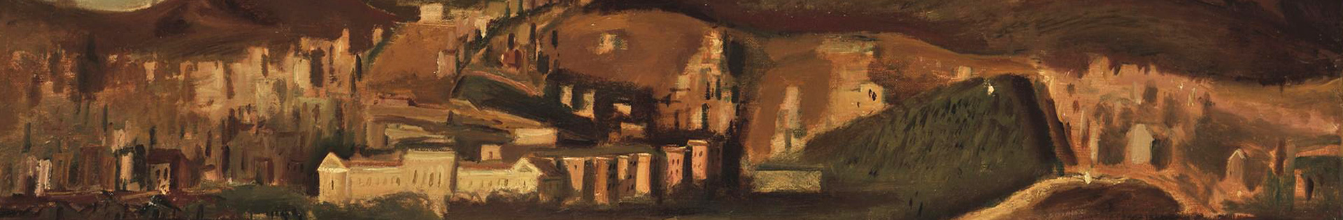
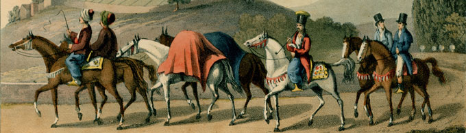
The database contains entries relating to printed publications (books and articles) or manuscripts by travellers, as well as illustrative material contained in them or in loose-leaf format (engravings illustrating landscapes, antiquities, human types, frontispieces of books, topographical plans, photographs, etc.)
Size: 2,500 (approximately) data-files relating to travel writings, and 500 (approximately) data-files on illustrations.
Members
Ioli Vingopoulou, Research Associate, Programme director
Giannis Papadopoulos, Research Collaborator
Former members
Under the guidance of the then Director of the Institute of Neohellenic Research (INR) Loukia Droulia, researchers from INR, along with external collaborators, took to retrieving valuable data from various public libraries and private collections of Greece and abroad: since October 1987 Ioli Vingopoulou; since September 1988, and for two years, Eliza-Anna Delveroudi; since 1990, and for ten years, Rania Poycandrioti; since 1993 and for three years Eugenia Drakopoulou; since 1995 and for five years George Tolias; since June 1992 and for four years, Ilia Chatzipanagioti.
Ongoing projects
An interactive web application was planned and subsequently realized within the operational programme “Information Society, Pandektis n. 2”. This interactive application is an extension of the project titled «Travel Literature on Southeast Europe and the Eastern Mediterranean (containing texts and illustrations) from the 15th to the 19th century” and the material is sourced from the project's databases, which have already become available to the scientific community and the general public via the Internet. I was in charge of the conceptual planning and scientific supervision of this application, running in Greek; modern multimedia applications, interactive media and animation were employed in planning and creating the application.
Under the general title “Travels to the Levant”, the application includes a map of Southeastern Europe and the East Mediterranean, with fifty active points marking cities and regions. By clicking these active points, with the option to choose from five different time periods, users have access to a total of four hundred engravings and more than two hundred and fifty extracts from works by travellers from Western Europe, in the original language and in translation, with thorough scientific documentation.
The contents of these extracts have been classified into fifteen thematic categories. They are excerpted from works by a hundred and ten representative travel writers (from the 15th century to the beginning of the 20th). Users have access to biographical notes on the authors, historical overviews of each city or region and informative introductory texts to each period of travelling, and to inland and maritime stopping points on travellers' itineraries. In all, users have the possibility to navigate a thousand pages on voyages to the East from the 15th to the early 20th century.
Publications
Loukia Droulia (ed.), On Travel Literature and related Subjects. References and Approaches, Athènes, INR/ FNRS, 1993, σ. 558.
(Editor) Tο ταξίδι από τους αρχαίους έως τους νεότερους χρόνους, [Traveling from the ancient to the modern times], «Eπιστήμης Kοινωνία», Eιδικές Mορφωτικές Eκδηλώσεις [in the framework of Special Educational Activities «Science and Society» organized by the NHRF] Athens, NHRF, 2003, p. 168
Le monde grec vu par les voyageurs du XVIe siècle, IRN/FNRS, Collection “Histoire des Ideés”- 4, Athènes 2004, p. 526
«Routes et logements des voyageurs dans la région de la Thrace (XVIe-XIXe siècles)» in The Historical Revue/La Revue Histοrique, INR/NHRF, volume VII (2010), 300-322.
Databases
Entries in Data base electronic form concern: 1) bibliographical information of the book content; 2) information about the traveller and his journey; and 3) independent index records for the subject of each illustration (in print or manuscript form).